Schema reference
The schema provides the authoritative definition of the structure of Risk Data Library Standard (RDLS) data, the meaning of each field, and the rules that must be followed to publish RDLS data. It is used to validate the structure and format of RDLS data.
For this version of RDLS, the canonical URL of the schema is https://docs.riskdatalibrary.org/en/0__2__0/rdls_schema.json. Use the canonical URL to make sure that your software, documentation or other resources refer to the specific version of the schema with which they were tested.
This page presents the schema in tables with additional information in paragraphs. You can also view the schema in an interactive browser or download it as JSON Schema.
Note
If any conflicts are found between the text on this page and the text within the schema, the text within the schema takes precedence.
The RDLS schema covers dataset fields, resource fields and four risk-specific components to describe risk datasets:
Hazard: Metadata that is specific to datasets that describe processes or phenomena that may cause loss of life, injury or other health impacts, property damage, social and economic disruption or environmental degradation. For example, a classification of the type of the hazard, the units in which the intensity of the hazard is measured, and the frequency at which the hazard occurs.
Exposure: Metadata that is specific to datasets that describe the location and demographic information of people, and the location, characteristics and value of assets in the built and natural environment. For example, the type of building and the cost to replace it if it suffered damage.
Vulnerability: Metadata that is specific to datasets that describe the vulnerability and fragility relationships and indexes used in risk analysis. This includes the type of exposure, hazard intensity and impact the relationship describes, and information on how the relationship was developed. This component uses attributes consistent with the hazard, exposure and loss components.
Loss: Metadata that is specific to datasets that contain the simulated (modeled) risk and impact estimates produced in a risk assessment, including explicit links to the hazard, exposure, and vulnerability datasets used in the analysis.
For general definitions of hazard, exposure, vulnerability and loss, please see the Glossary.
For fields that reference sub-schemas, a link is provided to a table with details of the sub-schema. To see how the fields and sub-schemas fit together, consult the schema browser.
Dataset
The top-level object in the RDLS schema is a risk dataset. A risk dataset is described as:
A collection of risk data, published or curated by a single entity, consisting of one or more resources and described using metadata structured according to the Risk Data Library Standard.
The general attributes of a dataset are described by fields based on the Data Catalog Vocabulary and the Dublin Core Metadata Initiative Metadata Terms.
The following diagram shows key dataset-level fields, with required fields highlighted in blue:
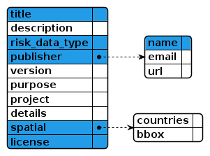
The following table lists all dataset-level fields:
Title |
Description |
Type |
Format |
Required |
|---|---|---|---|---|
id |
string |
Required |
||
Dataset identifier |
A unique identifier for the dataset. Use of an HTTP URI is recommended. For more information, see how to assign a dataset identifier. |
|||
title |
string |
Required |
||
Title |
The title of the dataset. |
|||
description |
string |
|||
Description |
A short description of the dataset. |
|||
risk_data_type |
array[string] |
Required |
||
Risk data type |
The types of risk data included in the dataset, from the closed risk_data_type codelist. |
|||
publisher |
object |
Required |
||
Publisher |
The entity responsible for making the dataset available. See Entity |
|||
version |
string |
|||
Dataset version |
The version indicator (name or identifier) of the dataset. |
|||
purpose |
string |
|||
Dataset purpose |
The purpose for which the dataset was created. |
|||
project |
string |
|||
Project title |
The name of the project that produced the dataset. |
|||
details |
string |
|||
Additional details |
Additional details about the dataset. |
|||
spatial |
object |
Required |
||
Spatial coverage |
The geographical area covered by the dataset. If specified using coordinates, the use of See Location |
|||
temporal_resolution |
string |
duration |
||
Temporal resolution |
The minimum period of time resolvable in this dataset, in ISO8601 duration format. |
|||
license |
string |
Required |
||
License |
A legal document giving official permission to do something with the dataset, taken from the open license codelist. A Public Domain Dedication or Open Definition Conformant license is recommended. Documents linked from this file may be under other license conditions. |
|||
contact_point |
object |
Required |
||
Contact point |
Contact information for the maintainer of the dataset. See Entity |
|||
creator |
object |
Required |
||
Creator |
The entity responsible for producing the dataset. See Entity |
|||
attributions |
array[Attribution] |
|||
Attributions |
Information about entities and their roles in relation to the dataset. See Attribution |
|||
sources |
array[Source] |
|||
Sources |
Sources of information that contribute to the creation of the dataset. See Source |
|||
referenced_by |
array[Related resource] |
|||
Referenced by |
Related resources, such as publications, that reference, cite, or otherwise point to the dataset. See Related_resource |
|||
resources |
array[Resource] |
Required |
||
Resources |
Information about the resources included in the dataset. See Resource |
|||
hazard |
object |
|||
Hazard metadata |
Metadata that is specific to datasets that describe processes or phenomena that may cause loss of life, injury or other health impacts, property damage, social and economic disruption or environmental degradation. |
|||
exposure |
object |
|||
Exposure metadata |
Metadata that is specific to datasets that describe the situation of people, infrastructure, housing, production capacities and other tangible human assets located in hazard-prone areas. |
|||
vulnerability |
object |
|||
Vulnerability metadata |
Metadata that is specific to datasets that describe the physical fragility and vulnerability relationships in relation to specific hazards or combinations of individual hazards. |
|||
loss |
object |
|||
Loss metadata |
Metadata that is specific to datasets that describe measures of impact in the form of damage or destruction caused by a disaster. |
|||
links |
array[Link] |
|||
Links |
Links to related resources. The purpose of this field is to declare the version of the RDLS schema that describes the metadata. The first item in the links array must be a link to the canonical URL of the RDLS JSON schema with relation type ‘describedby’. Subsequent items must conform to an IANA link relation type other than ‘describedby’. To link to sources of information that contribute to the creation of the dataset or to related resources that point to the dataset, use See Link |
|||
Resource
A Resource is defined as:
An individual file or other form of data. Resources can be fully informationally equivalent, such as CSV and JSON serializations of the same data. Resources can also have different levels of fidelity, such as a CSV file and a graphical representation of the data within the file. Resources can also differ in other aspects, such as the temporal coverage of each resource.
Each dataset can have many associated resources.
The following table lists all resource-level fields:
Title |
Description |
Type |
Format |
Required |
|---|---|---|---|---|
id |
string |
Required |
||
Resource identifier |
A locally unique identifier for this resource. |
|||
title |
string |
Required |
||
Resource title |
A title for this resource. |
|||
description |
string |
Required |
||
Resource description |
A description for this resource. |
|||
media_type |
string |
|||
Media type |
The media type of the resource, from the open media_type codelist. For example a custom binary file has media_type ‘application/octet-stream. A geojson file has the media_type ‘application/geo+json’. |
|||
format |
string |
Required |
||
Format |
A human-readable description of the file format of the resource, taken from the open data_formats codelist. |
|||
spatial_resolution |
number |
|||
Spatial resolution |
The minimum spatial separation resolvable in this resource, measured in meters. |
|||
coordinate_system |
string |
|||
Coordinate reference system |
An identifier string for the coordinate reference system (CRS) used in this resource. The CRS must be identified by a code issued by either EPSG or ESRI. The identifier string format is {authority}:{code}, e.g. EPSG:4326. https://epsg.io/ provides a searchable database of EPSG and ESRI coordinate system codes. |
|||
access_url |
string |
iri |
||
Access Url |
A web address that gives access to this resource, e.g. a webpage through which a user can request access by completing a form. |
|||
download_url |
string |
|||
Download Url |
The web address this resource can be downloaded from in the given |
|||
temporal |
object |
|||
Temporal coverage |
The period of time covered by this resource. See Period |
|||
Hazard metadata
The hazard component is described as:
Metadata that is specific to datasets that describe processes or phenomena that may cause loss of life, injury or other health impacts, property damage, social and economic disruption or environmental degradation.
The hazard component describes metadata about modeled natural hazards data, including hazard intensity footprints of historical or hypothetical events, return period hazard maps, hazard or susceptibility index, and stochastic event sets. The metadata defines the hazard type, physical process and intensity measures used in the dataset. Multiple hazards and processes (including cascading events) can be defined for each hazard, enabling users to describe dataset that contain, for example, earthquake ground shaking and liquefaction, and tsunami inundation triggered by the earthquake.
The hazard component uses hazard_type, process_type and intensity_measure consistent with the vulnerability and loss components of this standard. Spatial reference and location information are described using existing external standards. Temporal information can include date and duration of events or year of scenario, and is defined using the Dublin Core standards.
The following diagram shows key hazard component fields, with required fields highlighted in blue. The  icon indicates that a field is an array.
![@startjson
<style>
jsonDiagram {
BackGroundColor transparent
}
.required {
BackGroundColor #239ce8
}
</style>
#highlight "event_sets" <<required>>
#highlight "event_sets" / 0 / "analysis_type" <<required>>
#highlight "event_sets" / 0 / "events" / 0 / "calculation_method" <<required>>
#highlight "event_sets" / 0 / "events" / 0 / "hazard" <<required>>
#highlight "event_sets" / 0 / "events" / 0 / "hazard" / "type" <<required>>
#highlight "event_sets" / 0 / "events" / 0 / "hazard" / "processes" <<required>>
#highlight "event_sets" / 0 / "events" / 0 / "occurrence" <<required>>
#highlight "event_sets" / 0 / "events" / 0 / "footprints" / 0 / "intensity_measure" <<required>>
{
"event_sets": [
{
"analysis_type": "",
"frequency_distribution": "",
"seasonality": "",
"event_count": "",
"occurrence_range": "",
"spatial": "",
"temporal": "",
"events": [
{
"disaster_identifiers": "",
"calculation_method": "",
"description": "",
"hazard": {
"type": "",
"processes": "",
"intensity_measure": "",
"trigger": ""
},
"occurrence": "",
"footprints": [
{
"intensity_measure": "",
"data_uncertainty": ""
}
]
}
]
}
]
}
@endjson](../../_images/plantuml-f1912595a2469ea8a502d754c97fe18013acde21.png)
The following table lists all hazard component fields:
Title |
Description |
Type |
Format |
Required |
|---|---|---|---|---|
event_sets |
array[Event set] |
Required |
||
Event sets |
Information about sets of hazard events. See Event_set |
|||
event_sets/0/id |
string |
Required |
||
Event set identifier |
A locally unique identifier for this event set. |
|||
event_sets/0/hazards |
array[Hazard] |
Required |
||
Hazards |
The hazards included in this event set. See Hazard |
|||
event_sets/0/analysis_type |
string |
Required |
||
Analysis type |
The type of analysis used by the hazard model, from the closed analysis type codelist. |
|||
event_sets/0/frequency_distribution |
string |
|||
Frequency distribution |
The frequency distribution assumed for the occurrence of events over a multi-year timeline, from the frequency_distribution codelist. |
|||
event_sets/0/seasonality |
string |
|||
Seasonality distribution |
The seasonality distribution assumed for the occurrence of events across a calendar year, from the seasonality_distribution codelist |
|||
event_sets/0/calculation_method |
string |
|||
Calculation Method |
The methodology used for the calculation of the event set in the modelled scenario(s), taken from the closed data_calculation_type codelist. |
|||
event_sets/0/event_count |
number |
|||
Event count |
The number of events contained in the event set. You should only use this field when details of individual events are not included in the RDLS metadata. |
|||
event_sets/0/occurrence_range |
string |
|||
Occurrence range |
A summary of the probabilistic occurrence scenarios that are included in the event set. You should only use this field when |
|||
event_sets/0/spatial |
object |
|||
Spatial coverage |
The geographical area covered by the the hazard analysis in this event set. See Location |
|||
event_sets/0/temporal |
object |
|||
Temporal coverage |
The period of time covered by this event set. See Period |
|||
event_sets/0/events |
array[Event] |
|||
Events |
The events in this event set. See Event |
|||
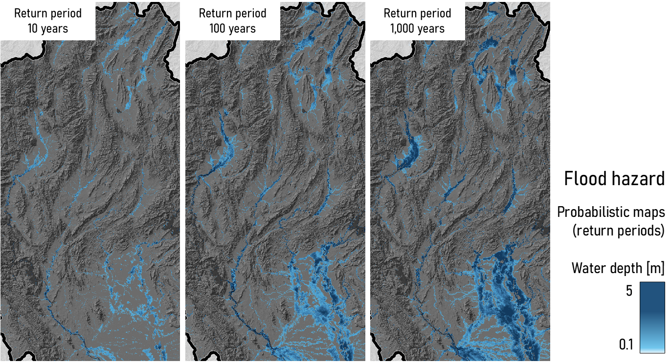
Example: Fathom Global Flood Map
The following example shows RDLS metadata for the Fathom Global Flood Map in tabular format and JSON format.
In tabular format, the metadata consists of several tables. To aid comprehension, the metadata is presented column wise using field titles.
Dataset identifier |
FTH_example |
|---|---|
Title |
FATHOM flood hazard maps |
Description |
Probabilistic modelling of fluvial and pluvial flood hazard |
Risk data type |
hazard |
Publisher: Name |
Fathom |
Publisher: URL |
https://www.fathom.global/ |
Dataset version |
2 |
Additional details |
The FATHOM flood-hazard model (previously known as SSBN), is a global gridded dataset of flood hazard produced at the global scale. It provides flood water extent and depth for a range of pluvial and fluvial hazard scenarios, expressed as “return period”, which indicates the probability of occurrence (i.e. once in 5, 10, 20, 50, 75, 100, 200, 250, 500, 750 and 1000 years). The Data are at 3 arc second (approximately 90m) resolution and have a global coverage between 56°S and 60°N. Each country set includes three subsets:
|
Spatial coverage: Spatial scale |
national |
License |
commercial |
Contact point: Name |
Mattia Amadio |
Contact point: Email address |
mamadio@worldbank.org |
Creator: Name |
Mattia Amadio |
Creator: Email address |
mamadio@worldbank.org |
Dataset identifier |
FTH_example |
FTH_example |
FTH_example |
|---|---|---|---|
Resource identifier |
1 |
2 |
3 |
Resource title |
Fluvial hazard - Undefended |
Fluvial hazard - Defended |
Pluvial hazard - Undefended |
Resource description |
Fluvial flood hazard maps (10), not accounting any flood defence |
Fluvial flood hazard maps (10), accounting for flood defence (estimate) |
Pluvial flood hazard maps (10), not accounting any flood defence |
Format |
geotiff |
geotiff |
geotiff |
Spatial resolution |
90 |
90 |
90 |
Coordinate reference system |
EPSG:4326 |
EPSG:4326 |
EPSG:4326 |
Download Url |
http://example.com/FTH-THA-fluvial-undefended |
http://example.com/FTH-THA-fluvial-defended |
http://example.com/FTH-THA-pluvial-undefended |
Dataset identifier |
FTH_example |
|---|---|
Event set identifier |
1 |
Analysis type |
probabilistic |
Calculation Method |
simulated |
Event count |
10 |
Occurrence range |
1/10 to 1/1000 years |
Spatial coverage: Spatial scale |
global |
Dataset identifier |
FTH_example |
FTH_example |
|---|---|---|
Event set identifier |
1 |
1 |
Hazard identifier |
1 |
2 |
Hazard type |
flood |
flood |
Hazard processes |
fluvial_flood |
pluvial_flood |
Intensity measure |
fl_wd:m |
fl_wd:m |
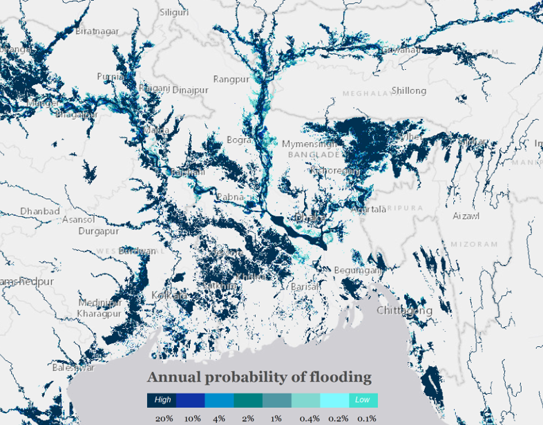
Example: Aqueduct Floods Hazard Maps
The following example shows RDLS metadata for the Aqueduct Floods Hazard Maps in tabular format and JSON format.
In tabular format, the metadata consists of several tables. To aid comprehension, the metadata is presented column wise using field titles.
Dataset identifier |
https://www.wri.org/data/aqueduct-floods-hazard-maps |
|---|---|
Title |
Aqueduct Floods Hazard Maps |
Description |
Aqueduct Floods is an online platform that measures riverine and coastal flood risks under both current baseline conditions and future projections in 2030, 2050, an 2080. In addition to providing hazard maps and assessing risks, Aqueduct Floods enables its users to conduct comprehensive cost-benefit analysis to evaluate the value of dike flood protection strategies. |
Risk data type |
hazard |
Publisher: Name |
Water Resource Institute |
Publisher: URL |
https://www.wri.org |
Dataset version |
2020 |
Project title |
Aqueduct |
Additional details |
The Aqueduct flood-hazard model is a global gridded dataset of flood hazard produced at the global scale. It provides flood water extent and depth for a range of pluvial and fluvial hazard scenarios, expressed as “return period”, which indicates the probability of occurrence (i.e. once in 2, 5, 10, 20, 50, 100, 250, 500 and 1000 years). The Data are at 1 km resolution and have a global coverage. |
Spatial coverage: Spatial scale |
global |
Contact point: Name |
Mattia Amadio |
Contact point: Email address |
mamadio@worldbank.org |
Creator: Name |
Water Resource Institute |
License |
CC-BY-4.0 |
Dataset identifier |
https://www.wri.org/data/aqueduct-floods-hazard-maps |
|---|---|
Resource identifier |
1 |
Resource title |
Flood hazard maps |
Resource description |
Collection of fluvial and pluvial hazard maps; baseline and climate scenarios |
Format |
geotiff |
Spatial resolution |
1000 |
Coordinate reference system |
EPSG:4326 |
Access Url |
http://wri-projects.s3.amazonaws.com/AqueductFloodTool/download/v2/index.html |
Dataset identifier |
https://www.wri.org/data/aqueduct-floods-hazard-maps |
|---|---|
Event set identifier |
1 |
Analysis type |
probabilistic |
Calculation Method |
simulated |
Event count |
10 |
Occurrence range |
1/2 to 1/1000 years |
Spatial coverage: Spatial scale |
global |
Dataset identifier |
https://www.wri.org/data/aqueduct-floods-hazard-maps |
https://www.wri.org/data/aqueduct-floods-hazard-maps |
|---|---|---|
Event set identifier |
1 |
1 |
Hazard identifier |
1 |
2 |
Hazard type |
flood |
flood |
Hazard processes |
fluvial_flood |
coastal_flood |
Intensity measure |
fl_wd:m |
fl_wd:m |
Exposure metadata
The exposure component is described as:
Metadata that is specific to datasets that describe the situation of people, infrastructure, housing, production capacities and other tangible human assets located in hazard-prone areas.
The exposure component describes metadata for datasets containing information on the distribution and characteristics of built environment assets (buildings and infrastructure) and natural assets and population, that are used in risk assessment. The exposure component provides codelists to describe the type of assets and costs, and the taxonomy scheme that is used to describe construction and demographic information contained in the dataset. For more information, see exposure standards.
The exposure component uses exposure categories consistent with the vulnerability and loss components of this standard. Spatial reference and location information are described using existing external standards. Temporal information can include date and duration of events or year of scenario, and is defined using the Dublin Core standards.
The following diagram shows key exposure component fields, with required fields highlighted in blue. The icon indicates that a field is an array.
![@startjson
<style>
jsonDiagram {
BackGroundColor transparent
}
.required {
BackGroundColor #239ce8
}
</style>
#highlight "exposure" / "category" <<required>>
#highlight "exposure" / "metrics" / 0 / "quantity_kind" <<required>>
{
"exposure": {
"category": "",
"taxonomy": "",
"metrics": [
{
"dimension": "",
"quantity_kind": ""
}
]
}
}
@endjson](../../_images/plantuml-2719fb43127a47359227430c8c10ef60a600cb06.png)
The following table lists all exposure component fields:
Title |
Description |
Type |
Format |
Required |
|---|---|---|---|---|
category |
string |
Required |
||
Exposure category |
The category of the exposed assets, from the closed exposure_category codelist. |
|||
taxonomy |
string |
|||
Exposure taxonomy scheme |
The name of the taxonomy scheme used to create descriptive individual asset feature strings within the dataset. |
|||
metrics |
array[Asset exposure metric] |
Required |
||
Exposure metrics |
The measurements used to quantify the extent to which assets are exposed. See Metric |
|||
Example: Central Asia projected residential exposure dataset
The following example shows RDLS metadata for the Central Asia projected residential exposure dataset in tabular format and JSON format.
hazard
Dataset identifier |
https://datacatalog.worldbank.org/search/dataset/0064254/Central-Asia-exposure-dataset—Projected-residential-exposure |
|---|---|
Title |
Central-Asia-exposure-dataset—Projected-residential-exposure |
Description |
Regional layer of residential buildings in Central Asia, projected to 2080 |
Risk data type |
exposure |
Publisher: Name |
World Bank |
Publisher: Email address |
sfraser@worldbank.org |
Publisher: URL |
http://www.worldbank.org |
Dataset version |
12 |
Dataset purpose |
Developed as part of the regional risk assessment, under the Strengthening Financial Resilience and Accelerating Risk Reduction in Central Asia program. (https://www.gfdrr.org/en/program/SFRARR-Central-Asia) |
Project title |
Strengthening Financial Resilience and Accelerating Risk Reduction in Central Asia |
Spatial coverage: Countries |
KAZ;KGZ;TJK;TKM;UZB |
License |
CC-BY-4.0 |
Contact point: Name |
Stuart Fraser |
Contact point: Email address |
sfraser@worldbank.org |
Creator: Name |
Risk Engineering and Development |
Creator: URL |
http://www.redrisk.com |
Exposure metadata: Exposure category |
buildings |
Exposure metadata: Exposure taxonomy scheme |
GED4ALL |
Dataset identifier |
https://datacatalog.worldbank.org/search/dataset/0064254/Central-Asia-exposure-dataset—Projected-residential-exposure |
https://datacatalog.worldbank.org/search/dataset/0064254/Central-Asia-exposure-dataset—Projected-residential-exposure |
https://datacatalog.worldbank.org/search/dataset/0064254/Central-Asia-exposure-dataset—Projected-residential-exposure |
|---|---|---|---|
Resource identifier |
0064254_res1 |
0064254_res2 |
0064254_res3 |
Resource title |
Central Asia projected (2080) residential exposure - all countries, Oblast level: SSP1 |
Central Asia projected (2080) residential exposure - all countries, Oblast level: SSP4 |
Central Asia projected (2080) residential exposure - all countries, Oblast level: SSP5 |
Resource description |
Central Asia projected (2080) residential exposure - for all five Central Asia countries included in the analysis, one file per Oblast (ADM1) for SSP1 Dataset includes projected residneital data for SSP1, SSP4, SSP5 scenarios. Files: RESIDENTIAL_[OBLAST].2080[SSP].csv |
Central Asia projected (2080) residential exposure - for all five Central Asia countries included in the analysis, one file per Oblast (ADM1) for SSP4 Dataset includes projected residneital data for SSP1, SSP4, SSP5 scenarios. Files: RESIDENTIAL_[OBLAST].2080[SSP].csv |
Central Asia projected (2080) residential exposure - for all five Central Asia countries included in the analysis, one file per Oblast (ADM1) for SSP5 Dataset includes projected residneital data for SSP1, SSP4, SSP5 scenarios. Files: RESIDENTIAL_[OBLAST].2080[SSP].csv |
Format |
csv |
csv |
csv |
Spatial resolution |
500 |
500 |
500 |
resources/0/downloadurl |
https://datacatalogfiles.worldbank.org/ddh-published/0064254/DR0091991/P2080_SSP1.zip?versionId=2023-07-11T15:12:01.4656749Z |
||
Temporal coverage: Start |
2080 |
2080 |
2080 |
Temporal coverage: End date |
2080 |
2080 |
2080 |
Download Url |
https://datacatalogfiles.worldbank.org/ddh-published/0064254/DR0091992/P2080_SSP4.zip?versionId=2023-07-11T15:12:06.1470219Z |
https://datacatalogfiles.worldbank.org/ddh-published/0064254/DR0091993/P2080_SSP5.zip?versionId=2023-07-11T15:12:03.5145140Z |
Dataset identifier |
https://datacatalog.worldbank.org/search/dataset/0064254/Central-Asia-exposure-dataset—Projected-residential-exposure |
https://datacatalog.worldbank.org/search/dataset/0064254/Central-Asia-exposure-dataset—Projected-residential-exposure |
|---|---|---|
Attribution identifier |
0064254_attr1 |
0064254_attr2 |
Entity: Name |
Chi-Yun Huang |
OGS, Italy |
Entity: Email address |
chuang@worldbank.org |
|
Role |
custodian |
collaborator |
Dataset identifier |
https://datacatalog.worldbank.org/search/dataset/0064254/Central-Asia-exposure-dataset—Projected-residential-exposure |
https://datacatalog.worldbank.org/search/dataset/0064254/Central-Asia-exposure-dataset—Projected-residential-exposure |
|---|---|---|
Related resource identifier |
0064254_ref1 |
0064254_ref2 |
Name |
Central Asia exposure data development technical report - English version |
Central Asia exposure data development technical report - Russian version |
URL |
https://datacatalogfiles.worldbank.org/ddh-published/0064117/DR0091010/Task4_Exposure_Report_r6_EN.pdf?versionId=2023-07-21T17:33:32.2845222Z |
https://datacatalogfiles.worldbank.org/ddh-published/0064117/DR0091011/Task4_Exposure_Report_r6_RU.pdf?versionId=2023-07-21T17:33:26.6527091Z |
Dataset identifier |
https://datacatalog.worldbank.org/search/dataset/0064254/Central-Asia-exposure-dataset—Projected-residential-exposure |
|---|---|
Source identifier |
0064254_src1 |
Dataset identifier |
https://datacatalog.worldbank.org/search/dataset/0064254/Central-Asia-exposure-dataset—Projected-residential-exposure |
https://datacatalog.worldbank.org/search/dataset/0064254/Central-Asia-exposure-dataset—Projected-residential-exposure |
https://datacatalog.worldbank.org/search/dataset/0064254/Central-Asia-exposure-dataset—Projected-residential-exposure |
https://datacatalog.worldbank.org/search/dataset/0064254/Central-Asia-exposure-dataset—Projected-residential-exposure |
https://datacatalog.worldbank.org/search/dataset/0064254/Central-Asia-exposure-dataset—Projected-residential-exposure |
|---|---|---|---|---|---|
Gazetteer entry identifier |
KAZ |
KGZ |
TJK |
TKM |
UZB |
Scheme |
ISO 3166-1 alpha-3 |
ISO 3166-1 alpha-3 |
ISO 3166-1 alpha-3 |
ISO 3166-1 alpha-3 |
ISO 3166-1 alpha-3 |
Dataset identifier |
https://datacatalog.worldbank.org/search/dataset/0064254/Central-Asia-exposure-dataset—Projected-residential-exposure |
|---|---|
Identifier |
0064254_metric1 |
Metric dimension |
structure |
Metric quantity kind |
currency |
Example: Central Asia current residential exposure dataset
The following example shows RDLS metadata for the Central Asia current residential exposure dataset in tabular format and JSON format.
In tabular format, the metadata consists of several tables. To aid comprehension, the metadata is presented column wise using field titles.
Dataset identifier |
https://datacatalog.worldbank.org/search/dataset/0064251/Central-Asia-exposure-dataset—Residential-buildings |
|---|---|
Title |
Central-Asia-exposure-dataset—Current-residential-exposure |
Description |
Regional layer of residential buildings in Central Asia |
Risk data type |
exposure |
Publisher: Name |
World Bank |
Publisher: Email address |
sfraser@worldbank.org |
Publisher: URL |
http://www.worldbank.org |
Dataset version |
12 |
Dataset purpose |
Developed as part of the regional risk assessment, under the Strengthening Financial Resilience and Accelerating Risk Reduction in Central Asia program. (https://www.gfdrr.org/en/program/SFRARR-Central-Asia) |
Project title |
Strengthening Financial Resilience and Accelerating Risk Reduction in Central Asia |
Spatial coverage: Countries |
KAZ;KGZ;TJK;TKM;UZB |
License |
CC-BY-4.0 |
Contact point: Name |
Stuart Fraser |
Contact point: Email address |
sfraser@worldbank.org |
Creator: Name |
Risk Engineering and Development |
Creator: URL |
http://www.redrisk.com |
Exposure metadata: Exposure category |
buildings |
Exposure metadata: Exposure taxonomy scheme |
GED4ALL |
Dataset identifier |
https://datacatalog.worldbank.org/search/dataset/0064251/Central-Asia-exposure-dataset—Residential-buildings |
https://datacatalog.worldbank.org/search/dataset/0064251/Central-Asia-exposure-dataset—Residential-buildings |
https://datacatalog.worldbank.org/search/dataset/0064251/Central-Asia-exposure-dataset—Residential-buildings |
https://datacatalog.worldbank.org/search/dataset/0064251/Central-Asia-exposure-dataset—Residential-buildings |
https://datacatalog.worldbank.org/search/dataset/0064251/Central-Asia-exposure-dataset—Residential-buildings |
|---|---|---|---|---|---|
Resource identifier |
0064251_res1 |
0064251_res2 |
0064251_res3 |
0064251_res4 |
0064251_res5 |
Resource title |
Central Asia exposure dataset - Residential buildings - KAZ |
Central Asia exposure dataset - Residential buildings - KGZ |
Central Asia exposure dataset - Residential buildings - TJK |
Central Asia exposure dataset - Residential buildings - TKM |
Central Asia exposure dataset - Residential buildings - UZB |
Resource description |
Central Asia exposure layers – Residential buildings - KAZ Files: RESIDENTIAL_[OBLAST].csv, RESIDENTIAL_[OBLAST].shp |
Central Asia exposure layers – Residential buildings - KGZ Files: RESIDENTIAL_[OBLAST].csv, RESIDENTIAL_[OBLAST].shp |
Central Asia exposure layers – Residential buildings - TJK Files: RESIDENTIAL_[OBLAST].csv, RESIDENTIAL_[OBLAST].shp |
Central Asia exposure layers – Residential buildings - TKM Files: RESIDENTIAL_[OBLAST].csv, RESIDENTIAL_[OBLAST].shp |
Central Asia exposure layers – Residential buildings - UZB Files: RESIDENTIAL_[OBLAST].csv, RESIDENTIAL_[OBLAST].shp |
Format |
csv |
csv |
csv |
csv |
csv |
Spatial resolution |
500 |
500 |
500 |
500 |
500 |
Download Url |
https://datacatalogfiles.worldbank.org/ddh-published/0064251/DR0091988/KAZ_residential_exposure.zip?versionId=2023-07-11T15:15:39.6450392Z |
https://datacatalogfiles.worldbank.org/ddh-published/0064251/DR0091661/KGZ_residential_exposure.zip?versionId=2023-07-11T15:15:41.4460187Z |
https://datacatalogfiles.worldbank.org/ddh-published/0064251/DR0091659/TKM_residential_exposure.zip?versionId=2023-07-11T15:15:34.9986705Z |
https://datacatalogfiles.worldbank.org/ddh-published/0064251/DR0091989/UZB_residential_exposure.zip?versionId=2023-07-11T15:15:43.2479984Z |
|
Temporal coverage: Start |
2020 |
2020 |
2020 |
2020 |
2020 |
Temporal coverage: End date |
2020 |
2020 |
2020 |
2020 |
2020 |
resources/0/url |
https://datacatalogfiles.worldbank.org/ddh-published/0064251/DR0091660/TJK_residential_exposure.zip?versionId=2023-07-11T15:15:37.7301236Z |
Dataset identifier |
https://datacatalog.worldbank.org/search/dataset/0064251/Central-Asia-exposure-dataset—Residential-buildings |
https://datacatalog.worldbank.org/search/dataset/0064251/Central-Asia-exposure-dataset—Residential-buildings |
|---|---|---|
Attribution identifier |
0064251_attr1 |
0064251_attr2 |
Entity: Name |
Chi-Yun Huang |
OGS, Italy |
Entity: Email address |
chuang@worldbank.org |
|
Role |
custodian |
collaborator |
Dataset identifier |
https://datacatalog.worldbank.org/search/dataset/0064251/Central-Asia-exposure-dataset—Residential-buildings |
https://datacatalog.worldbank.org/search/dataset/0064251/Central-Asia-exposure-dataset—Residential-buildings |
|---|---|---|
Related resource identifier |
0064251_ref1 |
0064251_ref2 |
Name |
Central Asia exposure data development technical report - English version |
Central Asia exposure data development technical report - Russian version |
URL |
https://datacatalogfiles.worldbank.org/ddh-published/0064117/DR0091010/Task4_Exposure_Report_r6_EN.pdf?versionId=2023-07-21T17:33:32.2845222Z |
https://datacatalogfiles.worldbank.org/ddh-published/0064117/DR0091011/Task4_Exposure_Report_r6_RU.pdf?versionId=2023-07-21T17:33:26.6527091Z |
Dataset identifier |
https://datacatalog.worldbank.org/search/dataset/0064251/Central-Asia-exposure-dataset—Residential-buildings |
|---|---|
Source identifier |
0064251_src1 |
Dataset identifier |
https://datacatalog.worldbank.org/search/dataset/0064251/Central-Asia-exposure-dataset—Residential-buildings |
https://datacatalog.worldbank.org/search/dataset/0064251/Central-Asia-exposure-dataset—Residential-buildings |
https://datacatalog.worldbank.org/search/dataset/0064251/Central-Asia-exposure-dataset—Residential-buildings |
https://datacatalog.worldbank.org/search/dataset/0064251/Central-Asia-exposure-dataset—Residential-buildings |
https://datacatalog.worldbank.org/search/dataset/0064251/Central-Asia-exposure-dataset—Residential-buildings |
|---|---|---|---|---|---|
Gazetteer entry identifier |
KAZ |
KGZ |
TJK |
TKM |
UZB |
Scheme |
ISO 3166-1 alpha-3 |
ISO 3166-1 alpha-3 |
ISO 3166-1 alpha-3 |
ISO 3166-1 alpha-3 |
ISO 3166-1 alpha-3 |
Dataset identifier |
https://datacatalog.worldbank.org/search/dataset/0064251/Central-Asia-exposure-dataset—Residential-buildings |
|---|---|
Identifier |
0064251_metric1 |
Metric dimension |
structure |
Metric quantity kind |
currency |
Vulnerability metadata
The vulnerability component is described as:
Metadata that is specific to datasets that describe the physical fragility and vulnerability relationships in relation to specific hazards or combinations of individual hazards.
The vulnerability component describes metadata for datasets that detail fragility, damage-to-loss and vulnerability relationships and indexes for physical damage and social vulnerability that are used in risk analysis. It contains key information including the type of function, intensity and impact metrics used, which asset types or population groups it applies to, how it was developed and for what locations.
The vulnerability component uses hazard_type, process_type and intensity_measure consistent with the hazard and loss components, exposure information consistent with the exposure and loss components. Spatial reference and location information are described using existing external standards.
The following diagram shows key vulnerability component fields, with required fields highlighted in blue:
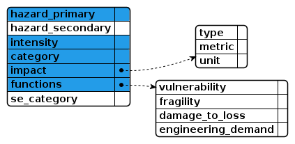
The following table lists all vulnerability component fields:
Title |
Description |
Type |
Format |
Required |
|---|---|---|---|---|
hazard_primary |
string |
Required |
||
Primary hazard type |
The primary hazard involved in the modelled scenario(s), from the closed hazard type codelist. |
|||
hazard_secondary |
string |
|||
Secondary hazard type |
The secondary hazard involved in the modelled scenario(s), from the closed hazard type codelist. |
|||
hazard_process_primary |
string |
|||
Primary hazard process |
The primary hazard process involved in the modelled scenario(s), from the closed hazard process type codelist. |
|||
hazard_process_secondary |
string |
|||
Secondary hazard process |
The secondary hazard process involved in the modelled scenario(s), from the closed hazard process type codelist. |
|||
hazard_analysis_type |
string |
|||
Hazard analysis type |
The type of analysis applied to the hazard data used in the modelled scenario(s), from the closed analysis type codelist. |
|||
intensity |
string |
Required |
||
Hazard intensity measurement |
The metric and units the hazard intensity measurement is given in, from the open intensity measure codelist. |
|||
category |
string |
Required |
||
Exposure category |
The category of the exposed assets, from the closed exposure_category codelist. |
|||
cost |
array[Asset cost] |
Required |
||
Asset cost |
The exposure costs associated with specific elements of assets detailed in the dataset. See Cost |
|||
taxonomy |
string |
|||
Exposure taxonomy scheme |
The name of the taxonomy scheme used to create descriptive individual asset feature strings within the dataset. Use of GED4ALL is recommended. |
|||
impact |
object |
Required |
||
Vulnerability impact |
The details of the vulnerability impact values produced in the modelled scenario(s). See Impact |
|||
spatial |
object |
Required |
||
Spatial coverage |
The geographical area to which the vulnerability function used in the modelled scenarios applies. See Location |
|||
functions |
object |
Required |
||
Impact functions |
Details of the functions used to calculate the vulnerability dataset. |
|||
functions/vulnerability |
object |
|||
Vulnerability function |
The vulnerability function used to calculate the impact of the hazard. |
|||
functions/vulnerability/approach |
string |
|||
Vulnerability function approach |
The approach the vulnerability function is based upon, taken from the closed function_approach codelist. |
|||
functions/vulnerability/relationship |
string |
|||
Vulnerability impact relationship type |
The type of function relationships used to calculate the vulnerability impact values, taken from the closed relationship_type codelist. |
|||
functions/fragility |
object |
|||
Fragility function |
The fragility function used to calculate the impact of the hazard. |
|||
functions/fragility/approach |
string |
|||
Fragility function approach |
The approach the fragility function is based upon, taken from the closed function_approach codelist. |
|||
functions/fragility/relationship |
string |
|||
Fragility impact relationship type |
The type of function relationships used to calculate the impact values, taken from the closed relationship type_codelist. |
|||
functions/fragility/damage_scale_name |
string |
|||
Damage scale name |
The name of the damage scale used in the fragility function, taken from the open damage_scale_name codelist. |
|||
functions/fragility/damage_states_names |
array[string] |
|||
Damage states names |
The names of the damage states listed in the fragility function. |
|||
functions/damage_to_loss |
object |
|||
Damage-to-loss function |
The damage-to-loss function (or damage-to-loss model) used to calculate the impact of the hazard in conjunction with a fragility function. |
|||
functions/damage_to_loss/approach |
string |
|||
Damage-to-loss function approach |
The approach the damage-to-loss impact function is based upon, taken from the closed function_approach codelist. |
|||
functions/damage_to_loss/relationship |
string |
|||
Damage-to-loss impact relationship type |
The type of function relationships used to calculate the damage-to-loss impact values, taken from the closed relationship_type codelist. |
|||
functions/damage_to_loss/damage_scale_name |
string |
|||
Damage scale name |
The name of the damage scale used in the damage-to-loss function, taken from the open damage_scale_name codelist. |
|||
functions/damage_to_loss/damage_states_names |
array[string] |
|||
Damage states names |
The names of the damage states listed in a damage scale. |
|||
functions/engineering_demand |
object |
|||
Engineering demand function |
The engineering demand function used to calculate the impact of the hazard. |
|||
functions/engineering_demand/parameter |
string |
|||
Engineering demand parameter |
The name of the engineering demand parameter, taken from the open engineering_demand_parameter codelist. |
|||
functions/engineering_demand/approach |
string |
|||
Engineering demand impact function approach |
The approach the engineering demand impact function is based upon, taken from the closed function_approach codelist. |
|||
functions/engineering_demand/relationship |
string |
|||
Engineering demand impact relationship type |
The type of function relationships used to calculate the engineering impact values, taken from the closed relationship_type codelist. |
|||
analysis_details |
string |
|||
Analysis details |
Additional details about the analysis used to produce the vulnerability function used in the modelled scenario(s). |
|||
se_category |
object |
|||
Socio-economic index category |
The socio-economic category vulnerable to the hazard. See Classification |
|||
Example: Global flood depth-damage functions
The following example shows RDLS metadata for the Global flood depth-damage functions in tabular format and JSON format.
In tabular format, the metadata consists of several tables. To aid comprehension, the metadata is presented column wise using field titles.
Dataset identifier |
https://publications.jrc.ec.europa.eu/repository/handle/JRC105688 |
|---|---|
Title |
Global flood depth-damage functions |
Description |
This dataset contains damage curves depicting fractional damage function of water depth as well as maximum damage values for a variety of assets and land use classes. |
Risk data type |
vulnerability |
Publisher: Name |
EU Joint Research Center (JRC) |
Publisher: URL |
https://publications.jrc.ec.europa.eu/repository/handle/JRC105688 |
Dataset version |
2017 |
Dataset purpose |
Assessing potential damage of flood events is an important component in flood risk management. Determining direct flood damage is commonly done using depth-damage curves, which denote the flood damage that would occur at specific water depths per asset or per land-use class. Many countries have developed flood damage models using depth-damage curves based on analysis of past flood events and on expert judgement. However, the fact that such damage curves are not available for all regions hampers damage assessments in some areas. Moreover, due to different methodologies employed for various damage models in different countries, damage assessments cannot be directly compared with each other, obstructing also supra-national flood damage assessments. |
Additional details |
Based on an extensive literature survey concave damage curves have been developed for each continent, while differentiation in flood damage between countries is established by determining maximum damage values at the country scale. These maximum damage values are based on construction cost surveys from multinational construction companies, which provide a coherent set of detailed building cost data across dozens of countries. A consistent set of maximum flood damage values for all countries was computed using statistical regressions with socio-economic World Development Indicators. Further, based on insights from the literature survey, guidance is also given on how the damage curves and maximum damage values can be adjusted for specific local circumstances, such as urban vs. rural locations or use of specific building material. This dataset can be used for consistent supra-national scale flood damage assessments, and guide assessment in countries where no damage model is currently available. |
Spatial coverage: Spatial scale |
global |
License |
CC-BY-4.0 |
Contact point: Name |
Mattia Amadio |
Contact point: Email address |
mamadio@worldbank.org |
Creator: Name |
EU Joint Research Center (JRC) |
Vulnerability metadata: Primary hazard type |
flood |
Vulnerability metadata: Hazard intensity measurement |
fl_wd:m |
Vulnerability metadata: Exposure category |
buildings |
Vulnerability metadata: Exposure taxonomy scheme |
internal |
Vulnerability metadata: Vulnerability impact: Impact type |
direct |
Vulnerability metadata: Vulnerability impact: Impact metric |
damage_ratio |
Vulnerability metadata: Vulnerability impact: Impact unit |
percentage |
Vulnerability metadata: Vulnerability impact: Impact base data type |
inferred |
Vulnerability metadata: Spatial coverage: Spatial scale |
global |
Vulnerability metadata: Impact functions: Fragility function: Fragility function approach |
hybrid |
Dataset identifier |
https://publications.jrc.ec.europa.eu/repository/handle/JRC105688 |
|---|---|
Resource identifier |
1 |
Resource title |
Global flood depth-damage functions database |
Resource description |
This spreadsheet contains two components required for flood damage assessment: fractional depth-damage functions and maximum damage values. The damage functions provide the share of asset that is damaged at a given flood depth, while the maximum damage values provide the associated maximum damage value for the given asset and, when combined together, they yield the monetary value of the damage. |
Format |
xlsx |
Download Url |
https://publications.jrc.ec.europa.eu/repository/bitstream/JRC105688/copy_of_global_flood_depth-damage_functions__30102017.xlsx |
Dataset identifier |
https://publications.jrc.ec.europa.eu/repository/handle/JRC105688 |
https://publications.jrc.ec.europa.eu/repository/handle/JRC105688 |
|---|---|---|
Attribution identifier |
1 |
2 |
Entity: Name |
JRC |
Jan Huizinga |
Entity: URL |
https://publications.jrc.ec.europa.eu/repository/handle/JRC105688 |
|
Role |
distributor |
author |
Dataset identifier |
https://publications.jrc.ec.europa.eu/repository/handle/JRC105688 |
|---|---|
Related resource identifier |
1 |
Name |
JRC Technical report - Global flood depth-damage functions |
Author names |
Jan Huizinga;Hans de Moel;Wojciech Szewczyk |
Publication date |
2017-04-12 |
URL |
https://publications.jrc.ec.europa.eu/repository/bitstream/JRC105688/global_flood_depth-damage_functions__10042017.pdf |
Digital object identifier |
10.2760/16510 |
Dataset identifier |
https://publications.jrc.ec.europa.eu/repository/handle/JRC105688 |
https://publications.jrc.ec.europa.eu/repository/handle/JRC105688 |
|---|---|---|
Cost identifier |
1 |
2 |
Cost dimension |
structure |
content |
Cost unit |
EUR |
EUR |
Loss metadata
The loss component is described as:
Metadata that is specific to datasets that describe measures of impact in the form of damage or destruction caused by a disaster.
The loss component provides metadata describing data generated in risk assessments, i.e., modelled impacts and losses for single historical events or hypothetical scenarios and risk estimates from analysis of large event sets. The data can include monetary and non-monetary, and direct or indirect, impacts and losses. Loss datasets can be explicitly linked to the exposure, hazard, and vulnerability datasets used in the analysis. This component uses descriptions of assets, hazards and impact types consistent with all other components of this standard. Spatial reference and location information are described using existing external standards. Temporal information can include date and duration of events or year of scenario, and is defined using the Dublin Core standards.
The following diagram shows key loss component fields, with required fields highlighted in blue. The icon indicates that a field is an array.
![@startjson
<style>
jsonDiagram {
BackGroundColor transparent
}
.required {
BackGroundColor #239ce8
}
</style>
#highlight "losses" / "0" / "hazard_type" <<required>>
#highlight "losses" / "0" / "cost" <<required>>
#highlight "losses" / "0" / "cost" / "type" <<required>>
#highlight "losses" / "0" / "cost" / "unit" <<required>>
{
"losses": [
{
"hazard_type": "",
"hazard_process": "",
"category": "",
"type": "",
"impact": {
"type": "",
"metric": "",
"unit": ""
},
"approach": "",
"cost": {
"type": "",
"unit": ""
}
}
]
}
@endjson](../../_images/plantuml-85d75db3aa794ecfe7946079199a82d156cdc441.png)
The following table lists all loss component fields:
Title |
Description |
Type |
Format |
Required |
|---|---|---|---|---|
losses |
array[Losses] |
|||
Losses |
Information about the losses described in the dataset. See Losses |
|||
losses/0/id |
string |
Required |
||
Losses identifier |
A local identifier for the losses. |
|||
losses/0/hazard_type |
string |
Required |
||
Hazard type |
The main type of hazard that resulted in the losses, from the closed hazard type codelist. |
|||
losses/0/hazard_process |
string |
|||
Hazard process |
The main hazard process that resulted in the losses, from the closed hazard process type codelist. |
|||
losses/0/description |
string |
|||
Loss description |
Additional details of the losses. |
|||
losses/0/category |
string |
|||
Asset category |
The category of the lost assets, from the closed exposure_category codelist. |
|||
losses/0/cost |
object |
Required |
||
Costs |
The costs associated with the losses. See Cost |
|||
losses/0/impact |
object |
|||
Loss impact |
Details of the way in which the loss impact was calculated and measured. See Impact |
|||
losses/0/type |
string |
|||
Loss type |
The type of losses, from the closed loss_type codelist. |
|||
losses/0/approach |
string |
|||
Loss approach |
The approach the loss calculation function is based upon, taken from the closed function_approach codelist. |
|||
losses/0/hazard_analysis_type |
string |
|||
Event frequency type |
The type of occurrence frequency represented in the losses, from the closed analysis_type codelist. |
|||
losses/0/hazard_id |
string |
|||
Hazard dataset |
A unique identifier for the hazard dataset used in calculating the losses. Use of an HTTP URI is recommended. |
|||
losses/0/exposure_id |
string |
|||
Exposure dataset |
A unique identifier for the exposure dataset used in calculating the losses. Use of an HTTP URI is recommended. |
|||
losses/0/vulnerability_id |
string |
|||
Vulnerability dataset |
A unique identifier for the vulnerability dataset used in in calculating the losses. Use of an HTTP URI is recommended. |
|||
Sub-schemas
Entity
Entity is defined as:
A person, organization or group.
This sub-schema is referenced by the following properties:
Each Entity has the following fields:
Title |
Description |
Type |
Format |
Required |
|---|---|---|---|---|
name |
string |
Required |
||
Name |
A name for the entity. |
|||
email |
string |
|||
Email address |
An email address for the entity. |
|||
url |
string |
iri |
||
URL |
A URL associated with the entity. |
|||
Attribution
Attribution is defined as:
A qualified relation between an entity and a dataset.
This sub-schema is referenced by the following properties:
Each Attribution has the following fields:
Title |
Description |
Type |
Format |
Required |
|---|---|---|---|---|
id |
string |
Required |
||
Attribution identifier |
A locally unique identifier for the attribution. |
|||
entity |
object |
Required |
||
Entity |
An entity with a role in relation to the dataset. See Entity |
|||
role |
string |
Required |
||
Role |
The entity’s role in relation to the dataset, using the open roles codelist. |
|||
Source
Source is defined as:
A source of information that contributes to the creation of a dataset.
This sub-schema is referenced by the following properties:
Each Source has the following fields:
Title |
Description |
Type |
Format |
Required |
|---|---|---|---|---|
id |
string |
Required |
||
Source identifier |
A locally unique identifier for the source. |
|||
name |
string |
|||
Name |
The name or title of the source. |
|||
url |
string |
iri |
||
URL |
The uniform resource locator for the source, e.g. the web address at which the source can be accessed. |
|||
type |
string |
|||
type |
The nature of the source, from the closed source_type codelist. |
|||
component |
string |
|||
Component |
The risk data component the source has been used in, from the closed risk_data_type codelist. |
|||
Period
Period is defined as:
A period of time.
This sub-schema is referenced by the following properties:
Each Period has the following fields:
Title |
Description |
Type |
Format |
Required |
|---|---|---|---|---|
start |
string |
|||
Start |
The start of the period. A date (YYYY-MM-DD) is recommended. However, year-months (YYYY-MM) and years (YYYY) are supported. |
|||
end |
string |
|||
End date |
The end of the period. A date (YYYY-MM-DD) is recommended. However, year-months (YYYY-MM) and years (YYYY) are supported. |
|||
duration |
string |
duration |
||
Duration |
The duration of the period in ISO 8601 duration format, e.g. ‘P50Y’ for 50 years |
|||
Location
Location is defined as:
A geographical area.
This sub-schema is referenced by the following properties:
Each Location has the following fields:
Title |
Description |
Type |
Format |
Required |
|---|---|---|---|---|
countries |
array[string] |
|||
Countries |
The countries covered by the geographical area, from the closed country codelist. |
|||
gazetteer_entries |
array[Gazetteer entry] |
|||
Gazetteer entries |
Entries from geographical indices or directories describing the geographical area. This field should be used to describe sub-national coverage. Use of ISO 3166-2 is recommended. See Gazetteer_entry |
|||
gazetteer_entries/0/id |
string |
Required |
||
Gazetteer entry identifier |
An identifier drawn from the gazetteer identified in |
|||
gazetteer_entries/0/scheme |
string |
|||
Scheme |
The gazetteer from which the entry is drawn, from the open location gazetteers codelist. |
|||
gazetteer_entries/0/description |
string |
|||
Description |
A description for the gazetteer entry. |
|||
gazetteer_entries/0/uri |
string |
iri |
||
Uniform resource locator |
A URI for the gazetteer entry. |
|||
bbox |
array[number] |
|||
Bounding box |
A geographic bounding box delimiting the geographical area. This field is an array of numbers. It must contain exactly four numbers with the first two numbers being the longitude and latitude of the most southwesterly point and the second two numbers being the longitude and latitude of the most northeasterly point. Coordinates must be specified using the World Geodetic System 1984 (WGS 84) datum, with longitude and latitude units of decimal degrees. This is equivalent to the coordinate reference system identified by the Open Geospatial Consortium URN urn:ogc:def:crs:OGC::CRS84. |
|||
geometry |
object |
|||
Geometry |
A set of coordinates denoting the vertices of the geographical area. This field describes the extent of the geographical area. To avoid creating very large metadata, geometries should have fewer than 50 vertices. See Geometry |
|||
centroid |
array[number] |
|||
Centroid |
The coordinates of the centre of the geographical area. This field is an array of numbers. It must contain exactly two numbers with longitude (easting) first and latitude (northing) second. Coordinates must be specified using the World Geodetic System 1984 (WGS 84) datum, with longitude and latitude units of decimal degrees. This is equivalent to the coordinate reference system identified by the Open Geospatial Consortium URN urn:ogc:def:crs:OGC::CRS84. |
|||
scale |
string |
|||
Spatial scale |
The spatial scale of the geographical area, from the closed spatial scale codelist. |
|||
Gazetteer_entry
Gazetteer_entry is defined as:
An entry from a geographical index or directory describing a geographical area.
This sub-schema is referenced by the following properties:
Each Gazetteer_entry has the following fields:
Title |
Description |
Type |
Format |
Required |
|---|---|---|---|---|
id |
string |
Required |
||
Gazetteer entry identifier |
An identifier drawn from the gazetteer identified in |
|||
scheme |
string |
|||
Scheme |
The gazetteer from which the entry is drawn, from the open location gazetteers codelist. |
|||
description |
string |
|||
Description |
A description for the gazetteer entry. |
|||
uri |
string |
iri |
||
Uniform resource locator |
A URI for the gazetteer entry. |
|||
Geometry
Geometry is defined as:
A set of coordinates denoting the vertices of the geographical area.
This sub-schema is referenced by the following properties:
Each Geometry has the following fields:
Title |
Description |
Type |
Format |
Required |
|---|---|---|---|---|
type |
string |
|||
Type |
The GeoJSON geometry type that is described by |
|||
coordinates |
array[[number, array]] |
|||
Coordinates |
One or more GeoJSON positions according to the GeoJSON geometry type defined in |
|||
coordinates/0 |
array[[number, array]] |
|||
None |
||||
coordinates/0/0 |
array[[number, array]] |
|||
None |
||||
coordinates/0/0/0 |
array[number] |
|||
None |
||||
Hazard
Hazard is defined as:
A phenomenon that may cause loss of life, injury or other health impacts, property damage, social and economic disruption or environmental degradation.
This sub-schema is referenced by the following properties:
Each Hazard has the following fields:
Title |
Description |
Type |
Format |
Required |
|---|---|---|---|---|
id |
string |
Required |
||
Hazard identifier |
A local identifier for this hazard. |
|||
type |
string |
Required |
||
Hazard type |
The hazard type for this hazard, from the closed hazard_type codelist. |
|||
processes |
array[string] |
Required |
||
Hazard processes |
The hazard process types for this hazard, from the closed hazard process type codelist. |
|||
intensity_measure |
string |
|||
Intensity measure |
The metric and unit in which the intensity of this hazard is measured, from the open intensity measure codelist. |
|||
trigger |
object |
|||
Trigger |
The cause of this hazard. See Trigger |
|||
Trigger
Trigger is defined as:
A cause of a hazard.
This sub-schema is referenced by the following properties:
Each Trigger has the following fields:
Title |
Description |
Type |
Format |
Required |
|---|---|---|---|---|
type |
string |
|||
Hazard type |
The hazard type for this hazard, from the closed hazard_type codelist. |
|||
processes |
array[string] |
|||
Hazard processes |
The hazard process types for this hazard, from the closed hazard process type codelist. |
|||
Event_set
Event_set is defined as:
Information about a set of hazard events.
This sub-schema is referenced by the following properties:
Each Event_set has the following fields:
Title |
Description |
Type |
Format |
Required |
|---|---|---|---|---|
id |
string |
Required |
||
Event set identifier |
A locally unique identifier for this event set. |
|||
hazards |
array[Hazard] |
Required |
||
Hazards |
The hazards included in this event set. See Hazard |
|||
hazards/0/id |
string |
Required |
||
Hazard identifier |
A local identifier for this hazard. |
|||
hazards/0/type |
string |
Required |
||
Hazard type |
The hazard type for this hazard, from the closed hazard_type codelist. |
|||
hazards/0/processes |
array[string] |
Required |
||
Hazard processes |
The hazard process types for this hazard, from the closed hazard process type codelist. |
|||
hazards/0/intensity_measure |
string |
|||
Intensity measure |
The metric and unit in which the intensity of this hazard is measured, from the open intensity measure codelist. |
|||
hazards/0/trigger |
object |
|||
Trigger |
The cause of this hazard. See Trigger |
|||
hazards/0/trigger/type |
string |
|||
Hazard type |
The hazard type for this hazard, from the closed hazard_type codelist. |
|||
hazards/0/trigger/processes |
array[string] |
|||
Hazard processes |
The hazard process types for this hazard, from the closed hazard process type codelist. |
|||
analysis_type |
string |
Required |
||
Analysis type |
The type of analysis used by the hazard model, from the closed analysis type codelist. |
|||
frequency_distribution |
string |
|||
Frequency distribution |
The frequency distribution assumed for the occurrence of events over a multi-year timeline, from the frequency_distribution codelist. |
|||
seasonality |
string |
|||
Seasonality distribution |
The seasonality distribution assumed for the occurrence of events across a calendar year, from the seasonality_distribution codelist |
|||
calculation_method |
string |
|||
Calculation Method |
The methodology used for the calculation of the event set in the modelled scenario(s), taken from the closed data_calculation_type codelist. |
|||
event_count |
number |
|||
Event count |
The number of events contained in the event set. You should only use this field when details of individual events are not included in the RDLS metadata. |
|||
occurrence_range |
string |
|||
Occurrence range |
A summary of the probabilistic occurrence scenarios that are included in the event set. You should only use this field when |
|||
spatial |
object |
|||
Spatial coverage |
The geographical area covered by the the hazard analysis in this event set. See Location |
|||
temporal |
object |
|||
Temporal coverage |
The period of time covered by this event set. See Period |
|||
events |
array[Event] |
|||
Events |
The events in this event set. See Event |
|||
events/0/id |
string |
Required |
||
Event identifier |
A locally unique identifier for this event. |
|||
events/0/disaster_identifiers |
array[Classification] |
|||
Disaster identifiers |
Identifiers for the disaster to which this event relates. See Classification |
|||
events/0/disaster_identifiers/0/scheme |
string |
|||
Scheme |
The scheme or codelist from which the classification code is taken, using the open classification_scheme codelist. |
|||
events/0/disaster_identifiers/0/id |
string |
Required |
||
Classification identifier |
The classification code taken from the scheme. |
|||
events/0/disaster_identifiers/0/description |
string |
|||
Description |
A textual description or title for the classification code. |
|||
events/0/disaster_identifiers/0/uri |
string |
iri |
||
URI |
A URI to uniquely identify the classification code. |
|||
events/0/calculation_method |
string |
Required |
||
Model calculation method |
The methodology used for the calculation of the event in the modelled scenario(s), from the closed data calculation type codelist. |
|||
events/0/hazard |
object |
Required |
||
Hazard |
The hazard to which this event relates. See Hazard |
|||
events/0/hazard/id |
string |
Required |
||
Hazard identifier |
A local identifier for this hazard. |
|||
events/0/hazard/type |
string |
Required |
||
Hazard type |
The hazard type for this hazard, from the closed hazard_type codelist. |
|||
events/0/hazard/processes |
array[string] |
Required |
||
Hazard processes |
The hazard process types for this hazard, from the closed hazard process type codelist. |
|||
events/0/hazard/intensity_measure |
string |
|||
Intensity measure |
The metric and unit in which the intensity of this hazard is measured, from the open intensity measure codelist. |
|||
events/0/hazard/trigger |
object |
|||
Trigger |
The cause of this hazard. See Trigger |
|||
events/0/hazard/trigger/type |
string |
|||
Hazard type |
The hazard type for this hazard, from the closed hazard_type codelist. |
|||
events/0/hazard/trigger/processes |
array[string] |
|||
Hazard processes |
The hazard process types for this hazard, from the closed hazard process type codelist. |
|||
events/0/occurrence |
object |
Required |
||
Occurrence |
The frequency or likelihood of the event happening within a given time frame. |
|||
events/0/occurrence/probabilistic |
object |
|||
Probabilistic frequency |
How often the event is expected to occur. Can be return period and/or probability. Both fields are provided to allow entry of return period (most common term used across all hazards) and/or probability, which is commonly used for seismic hazard. Probability commonly refers to a probability within 1 year or 50 years, but may be relative to any duration - when See Probabilistic |
|||
events/0/occurrence/probabilistic/return_period |
number |
|||
Return period |
The event return period (or recurrence interval); the estimated average time between events. Expressed as the denominator of ‘1/n’, e.g. ‘10’ for a 1-in-10 year return period etc. |
|||
events/0/occurrence/probabilistic/event_rate |
number |
|||
Event rate |
The average number of occurrences of the event within a given year. This is the reciprocal of the return period, related by event_set.frequency_distribution. |
|||
events/0/occurrence/probabilistic/probability |
object |
|||
Probability |
The likelihood of the event occurring in a given time period. |
|||
events/0/occurrence/probabilistic/probability/value |
number |
|||
Probability value |
The probability of the event occurring during the time period specified in |
|||
events/0/occurrence/probabilistic/probability/span |
number |
Required |
||
Probability span |
The length in years of the period in which the event is likely to occur with the probability specified in |
|||
events/0/occurrence/empirical |
object |
|||
Empirical |
The period of time over which the event occurred and the associated return period (if any). You should only use this object when |
|||
events/0/occurrence/empirical/temporal |
object |
|||
Temporal occurrence |
The period of time over which the event occurred. See Period |
|||
events/0/occurrence/empirical/temporal/start |
string |
|||
Start |
The start of the period. A date (YYYY-MM-DD) is recommended. However, year-months (YYYY-MM) and years (YYYY) are supported. |
|||
events/0/occurrence/empirical/temporal/end |
string |
|||
End date |
The end of the period. A date (YYYY-MM-DD) is recommended. However, year-months (YYYY-MM) and years (YYYY) are supported. |
|||
events/0/occurrence/empirical/temporal/duration |
string |
duration |
||
Duration |
The duration of the period in ISO 8601 duration format, e.g. ‘P50Y’ for 50 years |
|||
events/0/occurrence/empirical/return_period |
number |
|||
Associated return period |
Probabilistic frequency estimate associated with the empirical events in terms of hazard intensity. Expressed as the denominator of ‘1/n’, e.g. ‘10’ for a 1-in-10 year return period etc. |
|||
events/0/occurrence/deterministic |
object |
|||
Deterministic frequency |
The index criteria and thresholds classification used by the deterministic event set, index approaches and susceptibility data. You should only use this object when |
|||
events/0/occurrence/deterministic/index_criteria |
string |
|||
Index criteria |
Full description of the approach and criteria used to produce the index value. A deterministic hazard intensity index (ranking, score, etc) is not tied to a specific occurrence probability, rather is produced using an aggregation criteria (e.g. max, mean, median of annual values over a period; multi-criteria combination; Principal Component Analysis; else). |
|||
events/0/occurrence/deterministic/thresholds |
array[string] |
|||
Index thresholds |
The thresholds used to classify the index value. Each threshold should be a separate item. Where thresholds are identified by both a number and a descriptor, include the descriptor in brackets, e.g. 1 (low). |
|||
events/0/description |
string |
|||
Description |
Provides additional information about this specific event |
|||
events/0/footprints |
array[Footprint] |
|||
Footprints |
The footprints for this event showing spatial distribution of hazard intensity. See Footprint |
|||
events/0/footprints/0/id |
string |
Required |
||
Footprint identifier |
A locally unique identifier for this footprint |
|||
events/0/footprints/0/intensity_measure |
string |
Required |
||
Hazard intensity measurement |
The measurement unit used in the footprint, from the open intensity measure codelist. This is typically a measurement of intensity but can also take other forms, e.g. spectral velocity or flood water depth. |
|||
events/0/footprints/0/data_uncertainty |
string |
|||
Data uncertainty |
Details of the uncertainty of the footprint that should be taken into account when interpreting the data. |
|||
Event
Event is defined as:
A hazard event.
This sub-schema is referenced by the following properties:
Each Event has the following fields:
Title |
Description |
Type |
Format |
Required |
|---|---|---|---|---|
id |
string |
Required |
||
Event identifier |
A locally unique identifier for this event. |
|||
disaster_identifiers |
array[Classification] |
|||
Disaster identifiers |
Identifiers for the disaster to which this event relates. See Classification |
|||
disaster_identifiers/0/scheme |
string |
|||
Scheme |
The scheme or codelist from which the classification code is taken, using the open classification_scheme codelist. |
|||
disaster_identifiers/0/id |
string |
Required |
||
Classification identifier |
The classification code taken from the scheme. |
|||
disaster_identifiers/0/description |
string |
|||
Description |
A textual description or title for the classification code. |
|||
disaster_identifiers/0/uri |
string |
iri |
||
URI |
A URI to uniquely identify the classification code. |
|||
calculation_method |
string |
Required |
||
Model calculation method |
The methodology used for the calculation of the event in the modelled scenario(s), from the closed data calculation type codelist. |
|||
hazard |
object |
Required |
||
Hazard |
The hazard to which this event relates. See Hazard |
|||
occurrence |
object |
Required |
||
Occurrence |
The frequency or likelihood of the event happening within a given time frame. |
|||
occurrence/probabilistic |
object |
|||
Probabilistic frequency |
How often the event is expected to occur. Can be return period and/or probability. Both fields are provided to allow entry of return period (most common term used across all hazards) and/or probability, which is commonly used for seismic hazard. Probability commonly refers to a probability within 1 year or 50 years, but may be relative to any duration - when See Probabilistic |
|||
occurrence/probabilistic/return_period |
number |
|||
Return period |
The event return period (or recurrence interval); the estimated average time between events. Expressed as the denominator of ‘1/n’, e.g. ‘10’ for a 1-in-10 year return period etc. |
|||
occurrence/probabilistic/event_rate |
number |
|||
Event rate |
The average number of occurrences of the event within a given year. This is the reciprocal of the return period, related by event_set.frequency_distribution. |
|||
occurrence/probabilistic/probability |
object |
|||
Probability |
The likelihood of the event occurring in a given time period. |
|||
occurrence/probabilistic/probability/value |
number |
|||
Probability value |
The probability of the event occurring during the time period specified in |
|||
occurrence/probabilistic/probability/span |
number |
Required |
||
Probability span |
The length in years of the period in which the event is likely to occur with the probability specified in |
|||
occurrence/empirical |
object |
|||
Empirical |
The period of time over which the event occurred and the associated return period (if any). You should only use this object when |
|||
occurrence/empirical/temporal |
object |
|||
Temporal occurrence |
The period of time over which the event occurred. See Period |
|||
occurrence/empirical/temporal/start |
string |
|||
Start |
The start of the period. A date (YYYY-MM-DD) is recommended. However, year-months (YYYY-MM) and years (YYYY) are supported. |
|||
occurrence/empirical/temporal/end |
string |
|||
End date |
The end of the period. A date (YYYY-MM-DD) is recommended. However, year-months (YYYY-MM) and years (YYYY) are supported. |
|||
occurrence/empirical/temporal/duration |
string |
duration |
||
Duration |
The duration of the period in ISO 8601 duration format, e.g. ‘P50Y’ for 50 years |
|||
occurrence/empirical/return_period |
number |
|||
Associated return period |
Probabilistic frequency estimate associated with the empirical events in terms of hazard intensity. Expressed as the denominator of ‘1/n’, e.g. ‘10’ for a 1-in-10 year return period etc. |
|||
occurrence/deterministic |
object |
|||
Deterministic frequency |
The index criteria and thresholds classification used by the deterministic event set, index approaches and susceptibility data. You should only use this object when |
|||
occurrence/deterministic/index_criteria |
string |
|||
Index criteria |
Full description of the approach and criteria used to produce the index value. A deterministic hazard intensity index (ranking, score, etc) is not tied to a specific occurrence probability, rather is produced using an aggregation criteria (e.g. max, mean, median of annual values over a period; multi-criteria combination; Principal Component Analysis; else). |
|||
occurrence/deterministic/thresholds |
array[string] |
|||
Index thresholds |
The thresholds used to classify the index value. Each threshold should be a separate item. Where thresholds are identified by both a number and a descriptor, include the descriptor in brackets, e.g. 1 (low). |
|||
description |
string |
|||
Description |
Provides additional information about this specific event |
|||
footprints |
array[Footprint] |
|||
Footprints |
The footprints for this event showing spatial distribution of hazard intensity. See Footprint |
|||
footprints/0/id |
string |
Required |
||
Footprint identifier |
A locally unique identifier for this footprint |
|||
footprints/0/intensity_measure |
string |
Required |
||
Hazard intensity measurement |
The measurement unit used in the footprint, from the open intensity measure codelist. This is typically a measurement of intensity but can also take other forms, e.g. spectral velocity or flood water depth. |
|||
footprints/0/data_uncertainty |
string |
|||
Data uncertainty |
Details of the uncertainty of the footprint that should be taken into account when interpreting the data. |
|||
Footprint
Footprint is defined as:
Information about a single hazard event footprint showing spatial distribution of hazard intensity.
This sub-schema is referenced by the following properties:
Each Footprint has the following fields:
Title |
Description |
Type |
Format |
Required |
|---|---|---|---|---|
id |
string |
Required |
||
Footprint identifier |
A locally unique identifier for this footprint |
|||
intensity_measure |
string |
Required |
||
Hazard intensity measurement |
The measurement unit used in the footprint, from the open intensity measure codelist. This is typically a measurement of intensity but can also take other forms, e.g. spectral velocity or flood water depth. |
|||
data_uncertainty |
string |
|||
Data uncertainty |
Details of the uncertainty of the footprint that should be taken into account when interpreting the data. |
|||
Metric
Metric is defined as:
A measurement used to quantify the extent to which assets detailed in the dataset are exposed.
This sub-schema is referenced by the following properties:
Each Metric has the following fields:
Title |
Description |
Type |
Format |
Required |
|---|---|---|---|---|
id |
string |
Required |
||
Identifier |
A locally unique identifier for this metric. |
|||
dimension |
string |
Required |
||
Metric dimension |
The dimension on which the asset’s exposure is measured, from the closed metric_dimension codelist. |
|||
quantity_kind |
string |
Required |
||
Metric quantity kind |
The kind of quantity by which the exposure is quantified, from the open quantity_kind codelist. If the metric measures a quantity kind that is not included in the codelist, look up the correct code in the QUDT Quantity Kind Vocabulary. |
|||
Cost
Cost is defined as:
The costs associated with damage and disruption to specific elements of assets detailed in the dataset.
This sub-schema is referenced by the following properties:
Each Cost has the following fields:
Title |
Description |
Type |
Format |
Required |
|---|---|---|---|---|
id |
string |
Required |
||
Cost identifier |
A locally unique identifier for this cost. |
|||
dimension |
string |
Required |
||
Cost dimension |
The dimension of the assets that have incurred the cost, from the closed metric_dimension codelist. |
|||
unit |
string |
Required |
||
Cost unit |
The unit in which the cost is specified, from the closed currency codelist. |
|||
Probabilistic
Probabilistic is defined as:
How often the event is expected to occur. Can be return period and/or probability. Both fields are provided to allow entry of return period (most common term used across all hazards) and/or probability, which is commonly used for seismic hazard. Probability commonly refers to a probability within 1 year or 50 years, but may be relative to any duration - when
probabilityis used,spanmust be specified. This object must only be used ifevent_set.analysis_type= ‘probabilistic’
This sub-schema is referenced by the following properties:
Each Probabilistic has the following fields:
Title |
Description |
Type |
Format |
Required |
|---|---|---|---|---|
return_period |
number |
|||
Return period |
The event return period (or recurrence interval); the estimated average time between events. Expressed as the denominator of ‘1/n’, e.g. ‘10’ for a 1-in-10 year return period etc. |
|||
event_rate |
number |
|||
Event rate |
The average number of occurrences of the event within a given year. This is the reciprocal of the return period, related by event_set.frequency_distribution. |
|||
probability |
object |
|||
Probability |
The likelihood of the event occurring in a given time period. |
|||
probability/value |
number |
|||
Probability value |
The probability of the event occurring during the time period specified in |
|||
probability/span |
number |
Required |
||
Probability span |
The length in years of the period in which the event is likely to occur with the probability specified in |
|||
Impact
Impact is defined as:
The details of the impact values produced in the modelled scenario(s).
This sub-schema is referenced by the following properties:
Each Impact has the following fields:
Title |
Description |
Type |
Format |
Required |
|---|---|---|---|---|
type |
string |
|||
Impact type |
The type of impact calculated, taken from the closed impact_type codelist. |
|||
metric |
string |
|||
Impact metric |
The metric used to describe the impact, taken from the open impact_metric codelist. |
|||
unit |
string |
|||
Impact unit |
The unit the impact value is expressed in, taken from the open impact_unit codelist. |
|||
base_data_type |
string |
|||
Impact base data type |
The type of data used to calculate the impact values, taken from the closed data_calculation_type codelist. |
|||
Classification
Classification is defined as:
A classification consists of at least two parts: an identifier for the list (scheme) from which the classification is taken, and an identifier for the category from that list being applied. It is useful to also publish a text label and/or URI that users can draw on to interpret the classification.
This sub-schema is referenced by the following properties:
Each Classification has the following fields:
Title |
Description |
Type |
Format |
Required |
|---|---|---|---|---|
scheme |
string |
|||
Scheme |
The scheme or codelist from which the classification code is taken, using the open classification_scheme codelist. |
|||
id |
string |
Required |
||
Classification identifier |
The classification code taken from the scheme. |
|||
description |
string |
|||
Description |
A textual description or title for the classification code. |
|||
uri |
string |
iri |
||
URI |
A URI to uniquely identify the classification code. |
|||
Link
Link is defined as:
A link to a related resource.
This sub-schema is referenced by the following properties:
Each Link has the following fields:
Title |
Description |
Type |
Format |
Required |
|---|---|---|---|---|
href |
string |
iri |
Required |
|
Link target |
The URL of this related resource. |
|||
rel |
string |
Required |
||
Link relation type |
The relationship with this related resource, from the IANA Link Relationship Types. The ‘describedby’ code must only be used in the first item in the |
|||
Losses
Losses is defined as:
Losses resulting from the occurrence of a hazard.
This sub-schema is referenced by the following properties:
Each Losses has the following fields:
Title |
Description |
Type |
Format |
Required |
|---|---|---|---|---|
id |
string |
Required |
||
Losses identifier |
A local identifier for the losses. |
|||
hazard_type |
string |
Required |
||
Hazard type |
The main type of hazard that resulted in the losses, from the closed hazard type codelist. |
|||
hazard_process |
string |
|||
Hazard process |
The main hazard process that resulted in the losses, from the closed hazard process type codelist. |
|||
description |
string |
|||
Loss description |
Additional details of the losses. |
|||
category |
string |
|||
Asset category |
The category of the lost assets, from the closed exposure_category codelist. |
|||
cost |
object |
Required |
||
Costs |
The costs associated with the losses. See Cost |
|||
impact |
object |
|||
Loss impact |
Details of the way in which the loss impact was calculated and measured. See Impact |
|||
type |
string |
|||
Loss type |
The type of losses, from the closed loss_type codelist. |
|||
approach |
string |
|||
Loss approach |
The approach the loss calculation function is based upon, taken from the closed function_approach codelist. |
|||
hazard_analysis_type |
string |
|||
Event frequency type |
The type of occurrence frequency represented in the losses, from the closed analysis_type codelist. |
|||
hazard_id |
string |
|||
Hazard dataset |
A unique identifier for the hazard dataset used in calculating the losses. Use of an HTTP URI is recommended. |
|||
exposure_id |
string |
|||
Exposure dataset |
A unique identifier for the exposure dataset used in calculating the losses. Use of an HTTP URI is recommended. |
|||
vulnerability_id |
string |
|||
Vulnerability dataset |
A unique identifier for the vulnerability dataset used in in calculating the losses. Use of an HTTP URI is recommended. |
|||